Raster data is a type of digital data that stores information about a location using a grid of pixels or cells. Raster data is a type of digital data that stores information about a location using a grid of pixels or cells. You have squares with a single value and you color the value in based on that value. Raster data isn't really any different. Raster data is any pixel-based picture data (JPG, PNG, TIFF for example) which is loaded into the software. To know where in the world to "put" when it's displayed on screen, raster data is a type of digital data that stores information about a location using a grid of pixels or cells.
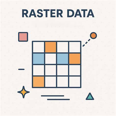
All rasters are built from a series of pixels (short for picture elements) arranged in rows and columns to create a grid pattern. Each pixel holds a single value, representing information such as color, elevation, or temperature. The grid structure makes rasters ideal for representing continuous surfaces and thematic data across landscapes.
Core Characteristics of Raster Data
- Grid-based: composed of rows and columns of square cells, like a digital photograph.
- Pixel values store phenomena such as category, magnitude, height, or spectral value.
- Pixel depth (bit depth) defines the range of possible values per pixel (8-bit, 16-bit, 32-bit).
- Cells can be NoData to indicate the absence of data, and rasters can be subsetted or mosaicked without altering original pixels.
- Rasters can be float (decimal) or integer (whole numbers) per pixel, never a mix within a single raster.
Because each pixel is a square and all rows and columns are coincident, the center-to-center distance between neighboring pixels is constant. This allows precise measurements on the Earth's surface, such as ground distance corresponding to one raster cell in a given projection.
Raster vs Vector: Foundational Distinctions
Raster data represents continuous phenomena and is well suited to modeling surfaces like elevation, temperature, or vegetation indices. Vector data, by contrast, uses points, lines, and polygons to represent discrete features such as roads, parcels, or boundaries. Understanding this difference is essential for choosing the right data type for a GIS task.
In practice, rasters are used as basemaps, surface maps, and thematic maps, while vectors provide precise boundaries and networks. Raster rasters are stored in formats such as GeoTIFF, JPEG, and PNG; vector data formats include Shapefile, GeoJSON, and KML. The two data types complement each other in analyses and visualization.
Raster Data Structures and Storage
In a raster, each cell represents a specific area on the Earth's surface, defined by the Ground Sampling Distance (GSD). A smaller GSD yields higher resolution and more detail, while a larger GSD reduces detail but keeps file sizes manageable. The location of each cell is defined by its row and column indices within the raster matrix, and the matrix can be referenced in a geographic coordinate system.
Rasters can be classified as thematic (discrete categories) or continuous (like elevation, temperature, or rainfall). Thematic rasters use integer values to represent Land Use or Land Cover types (e.g., forest, urban, water), often accompanied by a lookup table that maps values to categories. Continuous rasters store real-valued measurements across the surface.
Common Raster Types and Applications
- Elevation models (DEMs/DTMs): terrain analysis, flood modeling, viewshed analysis.
- Orthophotos/Orthomosaics: georeferenced photographs used as basemaps or land-use references.
- Satellite imagery: monitoring land cover changes, agriculture, urban planning.
- Land cover and land use rasters: categorizing surface types for environmental assessments.
- Climate and weather rasters: temperature, precipitation, humidity for environmental studies.
Rasters can also be used as attributes of features, such as linking a landscape parcel to an associated photograph or document. The choice between raster or vector storage depends on data characteristics, analysis needs, and storage constraints.
Raster Data Formats and Pixel Depth
- GeoTIFF (.tif): widely used, georeferenced raster with metadata.
- JPEG (.jpg): common photographic image format; not ideal for GIS analysis due to lossy compression.
- PNG (.png): lossless, supports transparency; suitable for web mapping.
Pixel depth (8-bit, 16-bit, 32-bit) determines the range of values per pixel. For example, unsigned 8-bit rasters store 0-255; signed 8-bit rasters store -128 to +127. Higher bit depths enable more precision and broader value ranges, but at the cost of larger file sizes.
Practical Aspects: Analysis and Processing
Raster analysis includes operations such as mosaicking (joining rasters), subsetting (cropping), and reprojecting to align with other layers. Rasters are inherently suited to surface analysis, including slope, aspect, and hydrological modeling, because their square cells provide a regular, gridded representation of space.
Classification rasters convert imagery into discrete land-cover categories by grouping multispectral values into classes. This makes rasters indispensable for land cover mapping, environmental monitoring, and suitability analyses where broad patterns matter more than exact feature boundaries.
raster data in Digital Imagery and GIS Workflows
In a typical GIS workflow, rasters can serve as basemaps to provide spatial context for vector layers, act as surface maps to model continuous phenomena, or be derived into thematic rasters through classification and geoprocessing. Tools like spatial analysts enable complex modeling using raster layers, and raster data often integrates with vector data in multi-layer analyses.
Rasters are resolution dependent and can be very large, especially at high resolutions. The decision to use raster over vector involves trade-offs between data structure simplicity, suitability for continuous data, storage requirements, and processing speed. Compression techniques (e.g., RLE, LZW) help reduce storage without sacrificing the ability to reconstruct values in lossless formats.
Summary of Key Points
- Rasters are grids of square cells with a single value per cell, representing continuous or discrete phenomena.
- They enable precise measurement on the Earth's surface due to the regular, aligned grid structure.
- Pixel depth and NoData values influence data range and data completeness.
- Raster vs vector: rasters excel at continuous data and imagery; vectors excel at discrete features and scalable boundaries.
- Common raster formats include GeoTIFF, JPEG, and PNG; vector formats include Shapefile, GeoJSON, and KML.
What are Vector and Raster Graphics?
Understanding rasters and vectors is fundamental in GIS, with each data type offering unique advantages for representing and analyzing geographic information. Rasters are an excellent choice when you need detailed imagery and continuous surfaces, whereas vectors provide precise, scalable representations of discrete features.